
Wacousta, Michigan
Wacousta, Michigan | |
|---|---|
 Location within Clinton County | |
 Wacousta Location within the state of Michigan  Wacousta Location within the United States | |
| Coordinates: 42°49′13″N 84°41′27″W / 42.82028°N 84.69083°W[1] | |
| Country | United States |
| State | Michigan |
| County | Clinton |
| Township | Watertown |
| Area | |
| • Total | 8.99 sq mi (23.29 km2) |
| • Land | 8.91 sq mi (23.09 km2) |
| • Water | 0.08 sq mi (0.20 km2) |
| Elevation | 824 ft (251 m) |
| Population (2020) | |
| • Total | 1,532 |
| • Density | 171.85/sq mi (66.35/km2) |
| Time zone | UTC-5 (Eastern (EST)) |
| • Summer (DST) | UTC-4 (EDT) |
| ZIP code(s) | |
| Area code | 517 |
| FIPS code | 26-82680[3] |
| GNIS feature ID | 2583768[1] |
Wacousta is an unincorporated community and census-designated place (CDP) in Clinton County in the U.S. state of Michigan. The CDP is located within Watertown Charter Township. As of the 2010 census, it had a population of 1,440.[4]
History
[edit]The community of Wacousta was listed as a newly-organized census-designated place for the 2010 census, meaning it now has officially defined boundaries and population statistics for the first time.[5]
Township date of Organization: March 20, 1837
Recognized as a Charter Township: December 8, 1966 [6]
In the heart of Michigan, along the winding Looking Glass River, a pioneering spirit took root. In 1837, a group of visionaries, drawn to the river's potential for water power, formed the Waterloo Joint Stock Company. Their ambitious goal was to establish a thriving community centered around a sawmill and gristmill.
The company purchased a substantial tract of land and began construction. A sawmill, gristmill, dwellings, and even a store soon materialized. However, the ambitious scale of their project outpaced the local population's needs, leading to financial difficulties. The property eventually changed hands several times, ultimately landing in the hands of Nathaniel I. Daniells.
Daniells, a New York native with a history of entrepreneurial ventures, saw potential in Wacousta. He purchased half of the property and leased the other half, becoming a pivotal figure in the town's development. His arrival marked a turning point, as he brought his determination and business acumen to the fledgling community.
Despite facing legal challenges and community resistance, Daniells persevered. He repaired the sawmill, established a gristmill, and played a key role in the town's growth. His efforts helped to attract other settlers and businesses, contributing to Wacousta's transformation into a thriving community.
Over the years, Wacousta continued to evolve. New industries emerged, including blacksmith shops and medical practices. The town also became a hub for local agriculture and commerce. Through the dedication and resilience of its early pioneers, Wacousta established itself as a cornerstone of the region's history.
Geography
[edit]The Wacousta CDP has a total area of 8.99 square miles (23.28 km2), of which 8.91 square miles (23.08 km2) is land and 0.08 square miles (0.21 km2) (0.89%) is water.[4]
The Looking Glass River flows from east to west across the CDP.
Demographics
[edit]| Census | Pop. | Note | %± |
|---|---|---|---|
| 2020 | 1,532 | — | |
| U.S. Decennial Census[7] | |||
This section needs expansion. You can help by adding to it. (January 2021) |
References
[edit]- ^ a b c U.S. Geological Survey Geographic Names Information System: Wacousta, Michigan
- ^ "2020 U.S. Gazetteer Files". United States Census Bureau. Retrieved May 21, 2022.
- ^ "Geographic Identifiers: 2010 Demographic Profile Data (G001): Wacousta CDP, Michigan". U.S. Census Bureau, American Factfinder. Archived from the original on February 12, 2020. Retrieved October 1, 2014.
- ^ a b "Michigan: 2010 Population and Housing Unit Counts 2010 Census of Population and Housing" (PDF). 2010 United States Census. United States Census Bureau. September 2012. p. 19 Michigan. Retrieved January 9, 2021.
- ^ "Michigan: 2010 Population and Housing Unit Counts 2010 Census of Population and Housing" (PDF). 2010 United States Census. United States Census Bureau. September 2012. p. III-5. Retrieved January 8, 2021.
- ^ https://www.watertownmi.gov/our-community/pages/watertown-history
- ^ "Census of Population and Housing". Census.gov. Retrieved June 4, 2016.
Municipalities and communities of Clinton County, Michigan, United States | ||
|---|---|---|
| Cities | 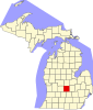 | |
| Villages | ||
| Charter townships | ||
| Civil townships | ||
| CDPs | ||
| Other communities | ||
| Footnotes | ‡This populated place also has portions in an adjacent county or counties | |